What makes a Firefighting Drone a top choice in 2026? Speed, thermal accuracy, flight endurance, and dependable operation matter more than promotional claims. The National Fire Protection Association reported approximately 1.5 million fires in the United States during 2023, with billions of dollars in direct property damage. These figures explain the demand for faster situational awareness, especially when smoke hides roof failures, trapped occupants, or spreading flames. A Firefighting Drone can provide an elevated thermal view within minutes, helping commanders identify hotspots without immediately exposing crews to unstable structures.
Industry forecasts also show strong growth in commercial drone adoption, although their market estimates differ because they use different definitions and regions. Reports from MarketsandMarkets and Grand View Research separately identify public safety, inspection, and emergency response as important growth areas. Their projections should guide research, not replace field testing. Real performance depends on wind, heat, battery temperature, network coverage, and pilot training. A drone that performs well in a calm demonstration may struggle beside a burning warehouse.
This guide examines the leading 2026 firefighting drones through practical criteria. These include thermal resolution, obstacle avoidance, payload options, water resistance, night operation, software integration, and regulatory readiness. Compliance with aviation rules remains essential, including applicable FAA operating requirements in the United States. The best platform is not always the largest or most expensive. Sometimes, a compact drone reaches the scene faster. That detail matters. Yet one weakness remains easy to overlook: drone data can overwhelm commanders when systems lack clear alerts and reliable workflows. The following comparison therefore considers measurable capability, operator experience, and the limits behind each specification.
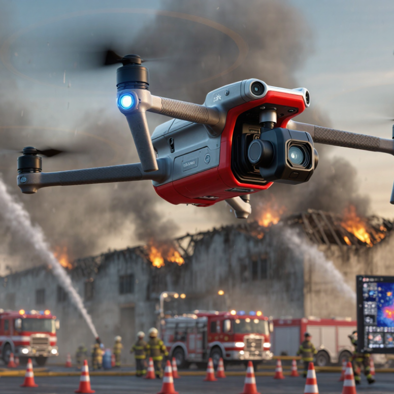
A top firefighting drone in 2026 is not simply the fastest aircraft in the sky. It must provide reliable information when heat, smoke, and poor visibility confuse ground crews. A high-resolution thermal camera can reveal hot roof sections, trapped heat, and fire movement. A daylight camera adds useful detail around windows, power lines, and access roads. Together, these sensors help commanders make safer decisions.
Reliability defines the strongest systems. The drone should remain stable in wind, return safely during low battery conditions, and transmit clear video over practical distances. Weather resistance matters because rain, ash, and sudden temperature changes can disrupt operations. Experienced teams also need simple controls, encrypted data links, and accurate location records. Training is essential. Even advanced equipment can create problems when operators misunderstand thermal images or fly too close to obstacles.
No drone is perfect.
A truly useful platform supports firefighters rather than replacing them. It may map a structure within minutes, monitor a changing hotspot, or check a damaged area before crews enter. Yet its readings can be affected by reflective surfaces, thick smoke, and blocked signals. That limitation deserves attention. The best evaluation includes field testing, maintenance records, pilot feedback, and independent safety checks. Performance on a calm test day is not enough. A top firefighting drone must remain useful when conditions become chaotic.

What Are the 2026 Top Firefighting Drones?
Core Technologies Used in Modern Firefighting Drones
The strongest firefighting drones combine thermal cameras, optical zoom, and multispectral sensors. Thermal imaging reveals people, hidden hotspots, and weakened roof sections through smoke. Optical cameras provide visual confirmation during daylight operations. LiDAR can map structures when visibility drops. No sensor sees everything.
Onboard artificial intelligence helps detect heat patterns and changing fire behavior. Edge computing processes data locally, reducing delays when networks become unstable. Some systems create live 3D maps for incident commanders. These maps show fire spread, blocked access routes, and safer entry points. Algorithms still misread reflective roofs and dense steam. That limitation matters.
Reliable communication is equally important. Mesh networking can maintain links between drones, crews, and control stations. Redundant navigation supports flight near tall buildings and heavy smoke. Weather-resistant frames, obstacle avoidance, and protected batteries improve field performance. Precise payload systems may deliver water, suppressant, or emergency equipment under authorized procedures. Human operators should retain control during uncertain conditions. In practice, battery endurance remains a weakness, especially during repeated high-wind flights. Better software cannot fully solve limited energy storage. Teams also need trained pilots, maintenance records, and verified data procedures before relying on autonomous support.
| Core Technology or Drone Type | Typical Technical Data | Primary Firefighting Application | Operational Advantages | Important Limitations |
|---|---|---|---|---|
| Thermal-Imaging Multirotor | Long-wave infrared sensing, commonly 7.5–14 μm; radiometric models record temperature values for each pixel. | Locating people, hidden hot spots, roof fires, smoldering material, and heat paths through smoke. | Provides a clear heat map when visible-light cameras are obscured by darkness or smoke; can support search, overhaul, and hotspot verification. | Heavy smoke, reflective metal, steam, and incorrect emissivity settings can reduce temperature-measurement accuracy. |
| High-Resolution Visual Camera System | 4K-class video is widely used; stabilized gimbals commonly provide optical and digital zoom functions. | Incident documentation, visual reconnaissance, structural observation, and coordination of crews around the fire perimeter. | Delivers real-time situational awareness and supports post-incident review without exposing personnel to unnecessary hazards. | Performance decreases at night, in dense smoke, during precipitation, or when the lens becomes contaminated. |
| Heavy-Lift Water or Suppressant Drone | Payload capacity varies widely; compact systems may carry several liters, while specialized aircraft can carry tens of liters. | Applying water, foam, retardant, or other approved suppressant to small fires, elevated structures, inaccessible areas, and wildfire edges. | Can deliver a targeted suppressant dose to locations that are unsafe or difficult for ground crews to reach. | Payload weight sharply reduces endurance; flight time, wind conditions, refill logistics, and local rules limit repeated applications. |
| Tethered Observation Drone | Ground-powered operation can support many-hour deployments; the tether also carries data and constrains altitude. | Continuous overwatch at large incidents, wildfires, industrial sites, and emergency staging areas. | Long persistence reduces battery-swap requirements and provides a stable elevated view for incident commanders. | Requires a ground station, suitable deployment space, tether management, and protection from strong winds or entanglement. |
| Beyond-Visual-Line-of-Sight (BVLOS) Platform | Uses approved command-and-control links, detect-and-avoid procedures, and airspace coordination; authorization is jurisdiction-dependent. | Wide-area wildfire mapping, perimeter tracking, infrastructure inspection, and operations beyond the pilot’s direct view. | Expands coverage and reduces the need to position personnel close to the hazard. | BVLOS operation is subject to aviation regulations, risk assessments, communications reliability, and emergency-airspace restrictions. |
| AI-Assisted Fire and Smoke Detection | Computer-vision models analyze visible and infrared imagery for smoke plumes, flames, heat anomalies, and changing fire boundaries. | Early detection, hotspot alerts, fire-edge monitoring, and prioritization of areas requiring human review. | Can process large image streams quickly and help operators identify changes that may be missed during prolonged incidents. | False alarms can result from dust, fog, clouds, reflections, industrial heat sources, and unusual terrain; human confirmation remains necessary. |
| LiDAR and 3D Mapping Payload | Produces point clouds and elevation models; useful mapping accuracy depends on sensor quality, flight geometry, and ground control. | Structural assessment, terrain mapping, volume estimation, burned-area measurement, and route planning. | Creates three-dimensional information for buildings, vegetation, cliffs, and damaged infrastructure, including areas with limited visual texture. | Smoke, rain, foliage density, reflective surfaces, and insufficient overlap can affect data quality; processing may require specialized software. |
| Mesh-Network and Multi-Drone Coordination | Aircraft can share telemetry, imagery, location data, and mission status through a local or cellular-connected network. | Coordinated perimeter mapping, simultaneous search sectors, relay coverage, and multi-team incident awareness. | Allows several aircraft to divide a large incident area and maintain a shared operational picture. | Interference, terrain blockage, network congestion, battery differences, and collision-avoidance requirements complicate coordination. |
| Search-and-Rescue Payload | May combine thermal imaging, loudspeakers, spotlights, microphones, and location beacons. | Finding missing people, communicating evacuation instructions, marking safe landing or access zones, and supporting disaster response. | Improves search speed and enables two-way communication in areas that may be unsafe for rescuers. | Human detection can be difficult under dense canopy, debris, smoke, or water; payload operation reduces flight endurance. |
| Obstacle-Avoidance and Autonomous Navigation | Combines satellite positioning, inertial sensors, optical flow, radar, ultrasonic sensing, or depth cameras. | Close inspection of buildings, bridges, towers, forests, and industrial facilities in complex environments. | Reduces collision risk and supports repeatable routes, automated return-to-home behavior, and precision hovering. | Smoke, dust, darkness, reflective surfaces, electromagnetic interference, and rapidly changing obstacles can degrade performance. |
| Ruggedized and Weather-Resistant Airframe | Professional systems often specify ingress protection, operating-temperature limits, wind tolerance, and redundant flight controls. | Operations in rain, dust, heat, cold, coastal air, and other demanding emergency environments. | Improves reliability and protects sensitive electronics during repeated deployments and rapid emergency response. | Higher protection usually adds weight, cost, and maintenance requirements; no rating makes a drone immune to extreme fire conditions. |
| Real-Time Incident-Command Integration | Uses encrypted video, geotagged imagery, live maps, telemetry, and standard geographic information system workflows. | Sharing aerial intelligence with command staff, dispatch centers, public-safety teams, and mutual-aid agencies. | Transforms drone footage into actionable information for evacuation decisions, resource allocation, and crew safety. | Requires interoperable software, secure communications, trained operators, adequate bandwidth, and clear data-retention procedures. |
| Rapid-Swap Battery and Charging Infrastructure | Flight endurance is commonly about 20–45 minutes for many multirotor configurations, depending on payload, wind, temperature, and battery condition. | Maintaining near-continuous aerial coverage during extended emergency operations. | Planned battery rotation, field charging, and spare power systems reduce downtime between missions. | Cold temperatures, high payloads, high winds, and battery aging reduce usable flight time; damaged lithium batteries require controlled handling. |
Note: Technical values are representative ranges or commonly used specifications for professional firefighting-drone configurations. Actual performance depends on airframe design, payload, weather, terrain, battery condition, communications coverage, and applicable aviation regulations.
What Are the 2026 Top Firefighting Drones?
Leading 2026 Firefighting Drone Types and Their Roles
Thermal-imaging multirotor drones lead many first-response teams in 2026. They hover near roofs, towers, and forest edges. Their infrared cameras reveal heat behind smoke, walls, and dark terrain. Crews can identify hotspots before sending people inside. These drones also map fire boundaries within minutes. A clear thermal image can guide hose placement and evacuation routes. However, thick metal structures may distort readings. Operators still need direct visual checks.
Tethered drones support long-duration monitoring above incident zones. A ground cable supplies continuous power and transfers live video. They are useful at warehouses, tunnels, and large industrial sites. Their fixed position improves communication coverage. They also reduce battery-change delays. The cable remains a practical weakness. Vehicles, trees, and unstable ground can restrict placement. Careful site planning matters.
Heavy-lift drones provide targeted water, foam, or cooling agents. Their role is usually limited to hot spots and hard-to-reach ledges. They cannot replace engines, aerial tankers, or trained firefighters. Payload changes also reduce flight time. A small drop may cool a surface but fail to stop internal burning. That limitation deserves more attention. In practice, the strongest response combines thermal scouting, tethered observation, and carefully controlled payload flights. Certified pilots must follow local aviation rules and department procedures. Human judgment remains essential when smoke, wind, and changing structures make sensor data incomplete.
Typical endurance ranges by firefighting drone type and its primary operational role. Actual performance varies with payload, weather, terrain, and battery configuration.
Operational overview: Thermal multirotors support hotspot detection and night reconnaissance; heavy-lift multirotors deliver water or suppressant to inaccessible areas; fixed-wing drones provide wide-area fire mapping; tethered drones enable persistent aerial observation and communications support.
The leading firefighting drones in 2026 are built for speed, visibility, and safer decision-making. They reach unstable areas before crews enter them. Thermal cameras reveal heat behind walls, across rooftops, and beneath heavy smoke. High-resolution cameras provide live views of blocked roads, damaged structures, and trapped equipment. Some aircraft also use laser mapping to create updated three-dimensional site models.
This information supports emergency response teams during the first critical minutes. Incident commanders can monitor fire spread from a safer position. Ground crews can receive clearer routes through radio-linked video feeds. A drone may identify a hot spot that looks harmless to the naked eye. It can also track changing wind conditions and help teams adjust evacuation zones. Small details matter here.
Not every flight is reliable. Thick smoke, strong winds, rain, and limited battery time can reduce performance. Thermal images may also confuse hot metal with active flames. Human verification remains essential. Operators need structured training, maintenance records, and clear communication with commanders. In practical exercises, teams should test signal loss and forced landings, not only successful flights. That uncomfortable planning often prevents confusion during real emergencies. Drones assist people. They do not replace fire crews, judgment, or local safety procedures.
When comparing firefighting drones in 2026, start with mission performance, not marketing claims. A useful drone should provide clear thermal images through smoke, darkness, and uneven weather. Its camera should detect heat differences around roofs, walls, and hidden hotspots. Optical zoom also helps operators inspect unstable structures from a safer distance. Image quality matters most when visibility suddenly drops.
Flight endurance remains a practical concern. A drone that claims long operation may carry less equipment or perform poorly in strong wind. Compare real flight time with the thermal camera, lighting system, and water-resistant housing installed. Battery replacement should be quick and safe during continuous operations. It needs to work in heat, dust, and light rain. Small details matter.
Communication range, obstacle avoidance, and control stability deserve equal attention. Dense buildings can weaken signals, while smoke can confuse automated navigation. Reliable systems should offer manual control, return-to-home protection, and recorded flight data. Operators should test these functions during realistic drills, not only in open fields. Payload capacity must match the task, whether carrying sensors, lighting, or limited suppressant equipment. More payload often reduces endurance.
Maintenance and training can decide operational value. Teams need replaceable parts, clear inspection procedures, and software updates with documented changes. Independent testing is more convincing than impressive specifications. A careful buyer should also review local aviation rules, emergency procedures, and data-handling requirements. No drone performs perfectly. Even experienced crews may misjudge wind, battery temperature, or signal loss during a fast-moving fire.
© 2023 JEM Electronics, Inc. – United States Cable Assembly. All rights reserved.